Download Maps and GPS Files From Table Below

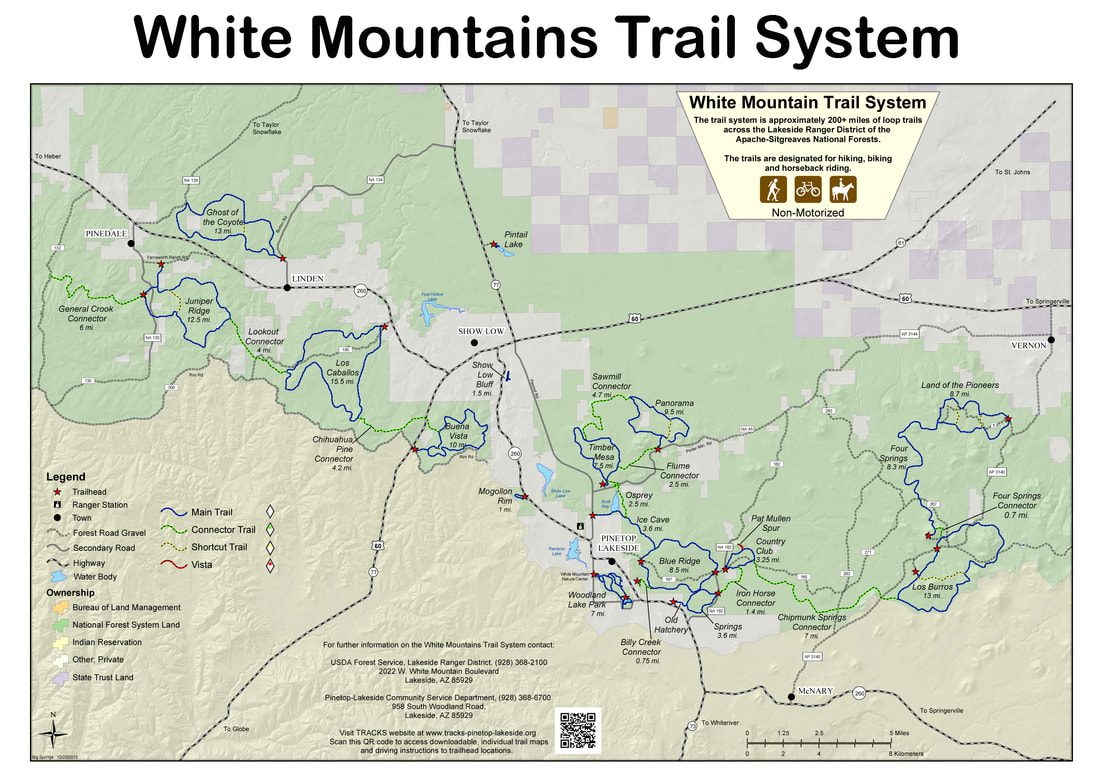
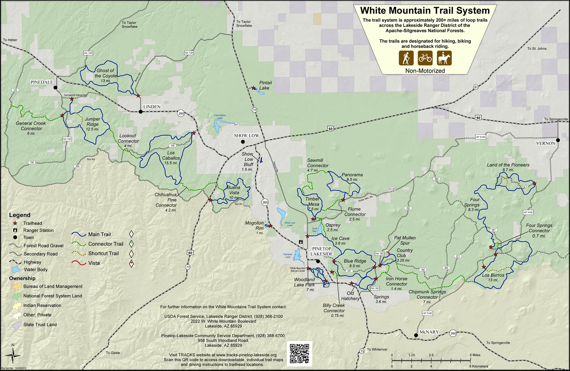
Be prepared—download a map of your trail before you go. To report downed trees or other issues, please use our contact form. You can open these GPX files on your iOS or Android device by downloading a GPX viewer. Click the appropriate app store button below to get the app.

TRAIL HIKE* BIKE* HORSEBACK* LENGTH (MILES) DOWNLOAD MAP DOWNLOAD GPS
Billy Creek E E E .75 MAP GPX
Blue Ridge M D M 9.4 MAP GPX
Buena Vista M D M 9.7 MAP GPX
Chihuahua Pine Connector D D D 4.4 ​Map GPX
Chipmunk Springs Connector M M M 7.5 MAP GPX
Country Club M E E 3.3 MAP GPX
Flume Connector M M M 2.1 MAP GPX
Four Springs D D D 8.3 MAP GPX
General Crook Connector M D D 6 MAP GPX
Ghost of the Coyote D D M 13 MAP GPX
Ice Cave M D M 3.4 MAP GPX
Iron Horse Connector E E E 1.6 MAP GPX
Juniper Ridge M D M 12.6 MAP GPX
Land of the Pioneers M D D 8.7 MAP GPX
Lookout Connector D D D 4 MAP GPX
Los Burros M M M 13 MAP GPX
Los Cabellos D D D 15.5 MAP GPX
Old Hatchery M D M .8 MAP GPX
Osprey M M M 2.5 MAP GPX
Panorama M M M 8.8 MAP GPX
Sawmill Connector M D M 4.4 MAP GPX
Show Low Bluff E E N/A 1.1 MAP GPX
Springs E M E 3.6 MAP GPX
Timber Mesa M D M 7.7 MAP GPX
Woodland Lake Park E E E VARIOUS MAP GPX
White Mountain Trail System VARIOUS VARIOUS VARIOUS 89.2 Trails E of Hwy 60 & N of Hwy 260
MAP
WMTS.GPX

Legend: *Difficulty level: E = easy; M = moderate; D = Difficult