Woodland Lake Park

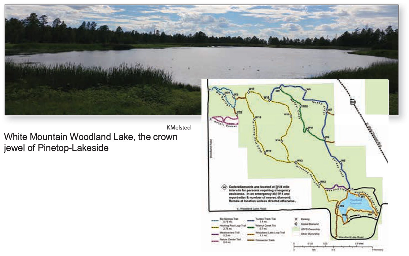
Trail Highlights: The majority of the trail system is a rural treasure within city limits. A paved ADA-designed trail winds around the lake. It is ideal for strollers, wheelchairs, or a brisk walk. It’s also nice when other park trails may be wet from heavy rain or snow and too muddy to use. For nature lovers who want to enjoy a peaceful walk along a stream, the park offers a beautiful 0.7-mile (one-way) footpath along Walnut Creek. For other outdoor enthusiasts, the lake provides a place for small boats and kayaks, and for fishermen to drop a line. Equestrians can also enjoy the park amenities. There is horse access on the Hitching Post Loop trail along the west side of the lake.

Deer can be seen in the park, and the pond at Big Springs attracts migratory fowl all year long since the water never freezes due to the spring’s constant flow of 800-1200 gallons per minute. Beavers occupy a lodge on the far side of Big Springs Pond. The Big Springs Trail connects to Woodland Lake Park via the Turkey Track or Hitching Post Trails, all well-signed.

Trail details

Distance: Woodland Lake Park has six connecting trails of varying lengths and habitats. The map indicates different trails and lengths. Equestrians can access the Hitching Post Trail (yellow loop) from the west side of the lake.

Difficulty: Hiking — Easy Mountain Biking — Easy Equestrian — Easy

Trail Parking: Parking at various locations in Woodland Lake Park and at Big Springs Environmental trailhead.

Trail Access: This trail system has two main entrances. Big Springs Environmental Study Area and Woodland Lake Park.

Big Springs Environmental Study Area: From Lakeside Ranger Station go 0.8 miles to Woodland Road. Turn Right. Go 0.6 miles to trailhead on the left.

Big Springs Trailhead GPS: N34°13’98”, W109°97’161”

Woodland Lake Park: Go 3.1 miles from LRD Office to Woodland Lake Road. Turn right on Woodland Rd and go 0.3 miles to the first entrance (the ramadas and boat dock).

Boat Dock Trailhead GPS: N34°12’805”, W109°95’261”

The second entrance (the ball fields and tennis courts) is 0 .1 mile west of first entrance.

Ball Park Entrance GPS: N34°124’, W109°948’

Get the map »

Get the iOS map app »

Get the Android map app »

JOIN TRACKS TODAY—CLICK HERE

©TAKE A HIKE 2021 — A COMPREHENSIVE WHITE MOUNTAIN TRAILS GUIDE