Trail Highlights: The Land of the Pioneers (LOP) Trail is a unique trail in that it offers interesting and beautiful land features as well as historical remnants from the past.
Winding through ponderosa and piñon pine and juniper trees, the trail ascends Ecks Mountain (L18) where excellent views of the eastern White Mountains can be seen. A box canyon with steep drop-offs and views to the east of cinder cones is located between white diamonds L23 – L24. There are ruins of a pioneer cabin located between L26 – L27.
Fact or fiction—take your pick—it has been said three sisters with gold hidden in the cabin were murdered by thieves looking for the stash. Reportedly, they never found anything.
Between white diamonds L29 – L30, the remains of another pioneer building may be seen with only the foundation remaining.
Land of the Pioneers is connected to Los Burros Trail by two trails that merge: Four Springs and Four Springs Connector.
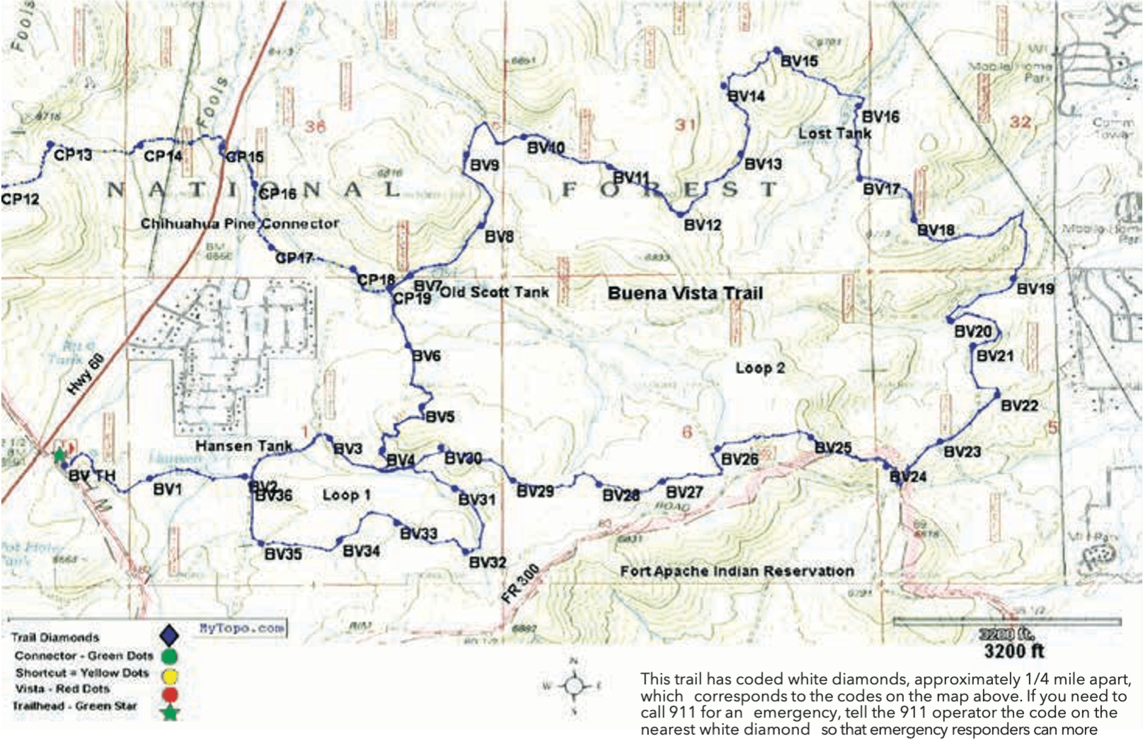
This trail has coded white diamonds, approximately 1/4 mile apart, that correspond to the codes on the map below. If you need to call 911 for an emergency, tell the 911 operator the code on the nearest white diamond so emergency responders can more readily locate you.
Four Springs Trail: Four Springs Trail winds south for 8 miles before connecting to Four Springs Connector Trail, which is .7 miles long. Hidden Lake, located between F22 – F23, and Four Springs can be seen
along the trail. Vat Spring is the site of an historic sheep camp; remnants of the dipping vat can be seen in the meadow, north of the tank near F28.
At the juncture of Four Springs Trail and Four Springs Connector is a spur that continues on to the trailhead of Four Springs, which is at a lookout tower on the top of Lake Mountain. Portions of the trail are extremely steep. Together Four Springs Trail and Four Springs Connector are 8.7 miles long, one way, and are rated difficult for all.